
Community map
Find Summer Hill within Pittsburgh and learn how the neighborhood took shape.
Summer Hill at a glance
- Location
- North Side of Pittsburgh
- ZIP code
- 15214
- City Council
- District 1
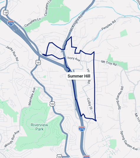
The blue outline identifies Summer Hill on the map supplied by the committee. Street labels, nearby parks, and Interstate 279 help orient visitors within the surrounding North Side area.
For additional context, open the City of Pittsburgh neighborhood map. City neighborhood boundaries and an RCO service area may differ.
From Harpen Hilltop to Summer Hill
Summer Hill was once part of Reserve Township. The area remained sparsely populated until the late 1960s, when a 51-acre residential development known as Harpen Hilltop was approved.
The development included 373 private homes and a 272-unit high-rise for older residents displaced from the East Street Valley during construction of Interstate 279. City planning maps used the Harpen Hilltop name in 1974. By 1977, neighborhood publications identified the larger area as Summer Hill and also referenced the neighboring Ivory Avenue district.
Today, the Summer Hill name encompasses the former Harpen Hilltop development and the Ivory Avenue area.
Neighborhood background drawn from historical material supplied by the Summer Hill Citizens Committee.